


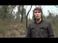
Gary Sheridan from the University of Melbourne is conducting Bushfire CRC research into bushfire threats to water quality.
Quantifying water quality risks following wildfire
This research, undertaken by the University of Melbourne’s Dr Gary Sheridan and Dr Petter Nyman, studied how the reduction of vegetation caused by bushfires can lead to major soil erosion. Erosion is increased with increased fire severity, increased rainfall intensity and steeper slopes. It is also likely to be greater in areas of the landscape that are normally drier.
The research sought to quantify the relationship between burn severity and the probability of water quality impacts in excess of water treatment thresholds in Australian catchments. This would help fire managers answer questions such as: “What are the real risks to uninterrupted water supply if this catchment is burnt by bushfire, and can I reduce this risk with prescribed fire?” The methods included model development, survey of extreme erosion events and field experiments to quantify the relationships between fire severity and hillslope hydrologic and erosion properties.
Dr Sheridan and Dr Nyman developed a model that predicts the distribution of erosion events. The model is directly applicable to landscapes of the Great Dividing Range from Kilmore in Victoria to the boundary of the Sydney Basin. The model can be used by planners to identify areas susceptible to erosion, help locate sediment control measures and help plan appropriate water supply and drainage infrastructure. The work may also be useful at a strategic level to inform water policy.
PhD research by Rene Van Der Sant at the University of Melbourne was connected to this work. Rene focused on using landscape dryness to assess the potential risk of extreme post-fire erosion events. Her study investigated landscape properties and processes that could be linked to hydro-geomorphic sensitivity, and how sensitive areas could be identified. Results of the study have important implications for the prediction of post-fire erosion.
Related News
Publications from this Project
Conference Proceedings
Journal Article
External References

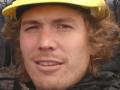
Water quality after bushfires. This project is being carried out in north-east Victoria in areas burnt on Black Saturday, 7 February 2009. The researchers are from the University of Melbourne. Interview with Petter Nyman.


")